Christchurch stretches from the ocean to
the foothills of the mountains and is completely flat. Abel Tasman discovered
New Zealand in 1642, Captain Cook sailed there a hundred years later. In 1850
the Canterbury Company, a group of leading British churchmen, sent six ships
with 1200 settlers (Canterbury Pilgrims) to Christchurch. Four ships sailed,
with the other two following a month later. Property was selling for 6 pounds
an acre.
Christchurch is located in the Cantabury
Plain, the flattest area in the country. The Canterbury Region also includes
the Southern Alps which are the highest peaks in the country.
The River Avon runs through the very
English city. Christchurch is the largest city on the South Island, and the third largest city in New Zealand,
after Auckland and Wellington. The streets all carry English names. Churches were the
focal point of the whole community, and the center city is dominated by
church spires. The present city is
compact and easy to explore, and very walkable. The streets were wide and the city had free center-city
tram and bus service
Our van
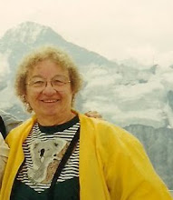
driver took us up 700 meters over a switch-back paved road into the mountains. At the summit, we had an
excellent view of Port Littleton, a deep-water,
active commerical harbor located in a volcano crator; on the other side of the road Christchurch
stretched to the sea. Seeing many felled trees it was explained that a recent
storm blew through the area doing a lot of damage. The road was open again
after weeks of closure. Slowly clean up was taking place. The city council
protected much of the mountain land. Both New Zealanders and Australians are
very outdoor and sports oriented and from the summit we could see many hiking trails.
They seemed to be everywhere!
After a punt ride on the River Avon, with large mansions on each side of
the river, we enjoyed a very
‘girlie’ lunch at the Mona Vale mansion. Afterward we wandered the beautiful gardens of the mansion. The weather was warm and quite comfortable.
‘girlie’ lunch at the Mona Vale mansion. Afterward we wandered the beautiful gardens of the mansion. The weather was warm and quite comfortable.
Everywhere
we went we noted children in school uniforms. This is the norm for all public
schools. The children also wear hats, many of them with neck flaps to guard
against the sun. People are very sun conscious.
As we rode and walked the charming city
we saw Victorian homes and their lovely English
Gardens. We learned of the country’s
favorite ice cream---hokey pokey, and of course we had to try it. It reminded my buddy of butter brickle, me
of pecan crunch without the nuts. Of course we are two ice creamaholics so
there was little doubt that we would enjoy the ice cream. Being from opposite
parts of the country accounted for our
slight variation on the name, but we both liked
hokey pokey.
Later
in the afternoon we walked about town visiting the Arts Center, museum, arts
and crafts center, the Cathedral and the Bridge of Remembrance.
The Bridge of Remembrance linking Oxford
and Cambridge Terraces over the River Avon at Cashel Street opened on Armistice
Day, 11 November 1924. It became a pedestrian area in 1977. The Bridge and its Arch of Remembrance serve
as a memorial to servicemen and women of two World Wars and subsequent
conflicts in Korea, Malaya, Borneo, and Vietnam. It replaces an earlier bridge
over which many thousands of soldiers marched en route from the barracks to the
railway station to overseas service. The Bridge of Remembrance was structurally
damaged in the February 2011 earthquake. Inspections suggested it was stable
and a decision was made to permanently repair the bridge.


No comments:
Post a Comment